
page updated
5 October 2010
Ashchurch & Malvern Line
This page includes
MR274 Evesham Junction to Tewksbury Junction
MR275 Malvern to Ashchurch (BR Engineer's Line Reference AAM)
MR276 Malvern Wells Sidings
MR277 Tewksbury Quay Branch
Chronology
| Date | Event |
|---|---|
| 1837 | Ashchurch to Tewksbury authorised as a branch of the Birmingham and Gloucester Railway. |
| 24 June 1840 | Ashchurch Station opened. |
| 21 July 1840 | Ashchurch to Tewksbury (1st station) opened as a single line. There were no powers to use steam locomotives with many early period trains worked by horse power. The prohibition was never repealed! Working by time interval. |
| c1844 | Line extended to Tewksbury Quay. |
| 25 May 1860 | Tewksbury & Malvern Railway incorporated and leased immediately by Midland Railway. |
| 1 July 1862 | Malvern Wells Station opened, plus line to Malvern Wells Junction. Working by time interval. |
| 16 May 1864 | Line and passenger service (only) diverted at Quay Branch Junction and opened to Malvern Wells. Tewksbury (2nd), Ripple and Upton Stations opened. Original line retained for goods traffic and Tewksbury (1st) Station closed to passengers and becomes Tewksbury Old Station (Goods). Tewksbury Junction to Tewksbury & Malvern Junction doubled. Working by time interval. |
| 1 October 1864 | Evesham Junction to Tewksbury Junction opened. Working by time interval. |
| 1 September 1870 | Tewksbury Quay Junction to Upton opened for goods traffic. |
| Before 1 November 1875 | Tewksbury Junction, Tewksbury and Malvern Wells Station Signal Boxes opened. |
| 1876 | Ashchurch to Tewksbury block telegraph working introduced. |
| 21 February 1877 | Malvern Junction Sidings opened. Malvern Wells Sidings Signal Box opened. |
| 1 July 1877 | Tewksbury & Malvern Railway vested (taken over) in Midland Railway. |
| April 1889 | Upton Station renamed Upton-on-Severn. |
| 8 July 1890 | Block telegraph working introduced between Tewksbury and Malvern Sidings in place of time interval working. Upton-on-Severn Signal box opened. |
| 8 August 1890 | Block telegraph working introduced throughout. |
| 5 November 1893 | Tewksbury Junction Signal Box replaced. |
| 1 February 1901 | Ashchurch ticket platform taken out. |
| 6 April 1902 | Tewksbury Signal Box reframed. |
| by 1904 | Malvern Junction Sidings renamed Malvern Sidings. |
| 21 February 1905 | Malvern Junction Sidings signal box replaced, old lever-frame moved into new box. |
| 18 January 1911 | Ripple Signal Box closed, replaced by ground frame. |
| 9 July 1913 | Tewksbury to Upton-on-Severn up line used for storing wagons; single line working by pilotman over down line. |
| 27 August 1913 | Tewksbury to Upton-on-Severn double line working reinstated. |
| 18 February 1914 | Tewksbury to Upton-on-Severn up line used for storing wagons; single line working by pilotman (pilot guard from 23 February) over down line. |
| 1 July 1914 | Tewksbury to Upton-on-Severn double line working reinstated. |
| 31 December 1916 | Tewksbury to Upton-on-Severn single line working by train staff and ticket introduced. |
| 18 May 1920 | Replacement Tewksbury Signal Box opened. |
| 1 January 1923 | Midland Railway incorporated into London Midland and Scottish Railway. |
| 16 October 1927 | Tewksbury Signal Box closed. |
| 9 November 1942 | Ripple ground frame removed. |
| 15 May 1945 | Replacement Malvern Wells Station signal box opened. |
| 26 May 1946 | Replacement Upton-on-Severn signal box opened. |
| 1946 | Malvern Sidings renamed Malvern New Midland Sidings. |
| 1 January 1948 | London Midland and Scottish Railway incorporated into British Railways. |
| 2 March 1951 | Malvern Wells Station renamed Malvern Hanley Road. |
| 1 December 1952 | Upton-on-Severn to Malvern Sidings Junction and Malvern Hanley Road Station closed. |
| September 1953 | Upton-on-Severn to Malvern New Midland Sidings track lifted. |
| 1 February 1957 | Tewksbury Loco Shed to Quay closed. |
| 5 May 1957 | Evesham Junction to Tewksbury Junction closed. |
| June 1958 | Tewksbury Junction to Tewksbury singled. |
| 20 July 1958 | Upton-on-Severn signal box closed and replaced by three ground frames. |
| 27 July 1958 | Ashchurch Junction (Tewksbury Line Junction) signal box on platform end replaced by new box on down side of B&GR. |
| by 19 May 1959 | New alignment into use between Tewksbury and Ripple (M50 bridge). |
| 14 August 1961 | Line closed for passengers. Tewksbury, Ripple & Upton-on-Severn Stations closed. Tewksbury Loco Shed closed. |
| 17 December 1961 | Ashchurch to Upton-on-Severn working changed to one engine in steam, replacing electric token working. Tewksbury Signal Box closed and replaced by ground frame for access to Quay Branch. Tewksbury Loco Shed and Chance Street Level Crossing to Oldbury Road Level Crossing closed. |
| 18 December 1961 | Ripple closed to goods. |
| c1961 | Track between Upton and Malvern taken up, land offered back to adjoining land owners in accord with original Act of Parliament. Most land owners took up the offer but one or two didn't which gave the Worcester Wildlife Trust the opportunity to purchase part of the route. |
| 7 September 1962 | Quay Branch Junction to Tewksbury Loco Shed closed together with the loco shed. |
| 1 July 1963 | Upton-on-Severn Goods closed. |
| 2 November 1964 | Ashchurch to Upton-on-Severn closed completely. |
| 1 May 1968 | Malvern New Midland Sidings, Malvern Wells Sidings Junction to Malvern Wells Junction closed. |
| 15 November 1971 | Ashchurch Station closed. |
| 1986 | Volume 2 of "An Historical Survey of Selected LMS Stations" published. Includes layout, signal box diagram and pictures of Upton-upon-Severn. |
| 30 May 1997 | Ashchurch for Tewksbury Station opens on site of main line platforms of previous station. |
Mileages & Infrastructure
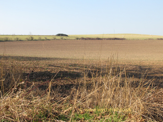
The initial seed of information is taken from the Midland Railway Distance Book, sheet 50, dated 1913. Mileages are in miles and chains with zero at Ashchurch (Tewksbury Line Junction) in accord with the Midland Railway's re-miling exercise of c1907. Mileages had previously been from zero at the Malvern end, precise zero point not currently known. Station mileages are quoted at mid point in accord with normal railway practice. Bridge numbers continue from MR272 Barnt Green - Ashchurch via Evesham line. Down direction is Derby > Worcester > Malvern > Ashchurch, except for MR274 which Down from Derby via Evesham.
A Google earth locations file is available.
| *** MR276 *** | |||
|---|---|---|---|
| Distance | Lat/Long | Pin | Location & Comments |
| 13m 29c | N W |
End of line, Malvern Wells Sidings | |
| 13m 15c | N52.099560 W2.321517 |
[5] | Malvern Wells Sidings Signal Box. See MR275 for details. |
| 13m 13c | N W |
[0] | Malvern Wells Sidings Junction. See MR275 for details. |
19 May 2010
now public footpath to [425]

19 May 2010
now private farmland
![]()
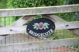
19 May 2010
now private drive
19 May 2010
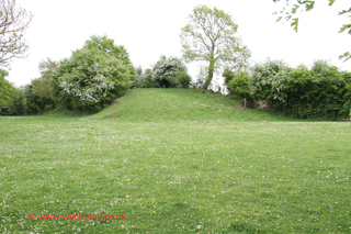
two trees now mark the platforms site
![]()
| Distance | Lat/Long | Pin | Location & Comments |
|---|---|---|---|
| 11m 58c | N52.0787659 W2.315605 |
[400] | Malvern Wells Station. Referred to by Bradshaw in 1882/3 as Malvern Wells Hanley Road and this appeared in LMSR timetable in October 1947. Formally renamed by British Rail from 2 March 1951. The station and goods yard have been completely erased and there is nothing now visible to suggest they ever existed. |
| 11m 55c | N W |
Malvern Wells Signal Box. Located on up side. | |
| N W |
[385] | Start of station area widening. | |
| N52.075501 W2.305544 |
[380] | Possible accomodation underbridge, or more likely a footpath crossing. Now on private land, no public access. | |
| N52.074756 W2.303188 |
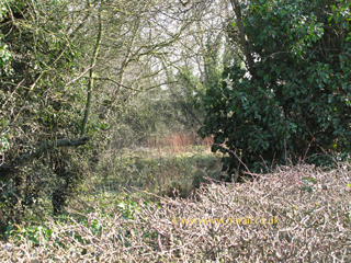
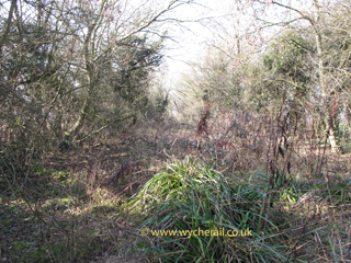
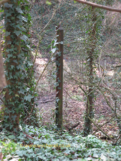
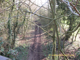
[375] | Overbridge, Blackmore Park Road. There is nothing here now to suggest that a bridge ever existed. The embankment approach shown on the 1896 OS map each side of the line has been levelled out and the shallow railway cutting has filled in so that road and railway route are now on the same level. Location MR275 [375] Pictures ... |
8 March 2011
the line passed under the large shadow
in the middle of the view
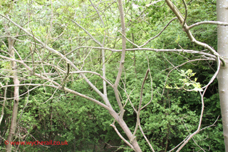
8 March 2011
vegetation take over
the jungle continues to [370]
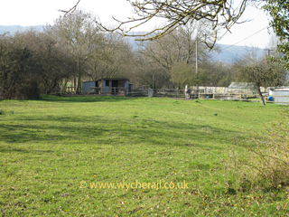
8 March 2011
the line passed in front of the trees and through where the shed now stands
![]()
| Distance | Lat/Long | Pin | Location & Comments |
|---|---|---|---|
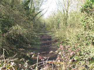
| N52.073569 W2.299318 |
[370] | Public Footpath Crossing. The footpath is still in use and dips down into the shallow cutting. The line of the trackbed is still visible but is now private land with no public access. Location MR275 [370] Pictures ... |
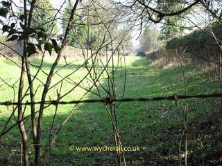
8 March 2011
now a linear meadow
note the barbed wire
8 March 2011
vegetation take over
the jungle continues to [375]
![]()
| Distance | Lat/Long | Pin | Location & Comments |
|---|---|---|---|
| N52.073059 W2.297619 |
[365] | Underbridge? Site is private land, no public access. | |
| N 52.072975 W2.297391 |
[360] | Mile post. Estimated position from 1886 OS map. Removed by MR Engineer c1907. | |
| N52.071200 W2.291271 |
[355] | Footpath (or underbridge) or quite possibly nothing. | |
| N52.070712 W2.288373 |
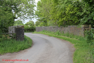
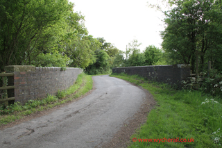
[350] | Underbridge, Gloucester Road, Welland. Pictures. |
Location MR275 [350] Pictures ...
19 May 2010
embankment trimmed well back
19 May 2010
in the name of the bungalow adjoining
![]()
19 May 2010
car parking out of view, left.
19 May 2010
19 May 2010
from over the parapet
19 May 2010
from over the parapet - jungle ahead
19 May 2010
alongside the trackbed
19 May 2010
well vegetated haven for butterflies
19 May 2010
19 May 2010
19 May 2010
the unkempt jungle
![]()
| Distance | Lat/Long | Pin | Location & Comments |
|---|---|---|---|
| N52.068786 W2.264795 |
[315] | Mile Post. Estimated position from 1886 OS map. Removed by MR Engineer c1907. | |
| N52.068525 W2.261389 |
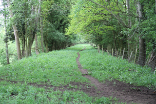
[310] | Public footpath still in use. Part of the embankment towards [305] was removed some years ago to improve agricultural movement round the farm. The track bed is private land with no public access. Location MR275 [310] Pictures ... |
8 March 2011
embankment section removed
8 March 2011
well overgrown
![]()
| Distance | Lat/Long | Pin | Location & Comments |
|---|---|---|---|
| N52.068211 W2.257515 |
[305] | Mile post. Estimated position from 1886 OS map. Removed by MR Engineer c1907. | |
| N52.067972 W2.254534 |
[300] | Accomodation crossing. | |
| N52.067757 W2.251790 |
[295] | Mile post. Estimated position from 1886 OS map. Removed by MR Engineer c1907. Much of the embankment between here and [310] has been raised since the line closed so as to act as a sound barrier against clay pigeon shooting which is now carried on south of the line. | |
| N52.067327 W2.246007 |
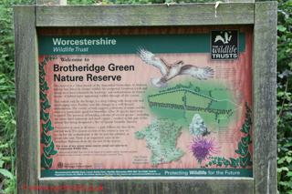
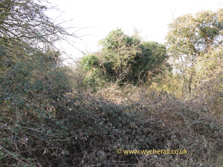
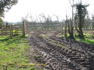
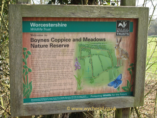
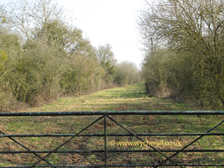
[290] | Public footpath crossing linking Brotheridge Road with Hook Road. The footpath is still in use and new gates have been erected both sides of the line. The track bed towards [285] appears to be walkable although it is private land. The Boynes nature reserve occupies the meadows immediately south of the railway line. Location MR275 [290] Pictures ... |
8 March 2011
north side of line
8 March 2011
south side of line
8 March 2011
appears walkable
8 March 2011
cattle on the line
![]()
| Distance | Lat/Long | Pin | Location & Comments |
|---|---|---|---|
| N52.065686 W2.237301 |
[285] | Public footpath crossing linking New Street and West Bank, Upper Hook Road. The footpath is still in use. Steps down embankment each side of line. The track bed is walkable as far as [280] and part of the way towards [290]. Location MR275 [285] Pictures ... |
8 March 2011
this ran left (Ashchurch direction) to right
(Malvern direction)in a cutting dividing the
ploughed field from the meadow on the
horizon
8 March 2011
over the stile then walkable to [280]
8 March 2011
walkable towards [290]
8 March 2011
at the top of the steps, north side
old bull head rail reused
to carry the usual warning signs
![]()
| Distance | Lat/Long | Pin | Location & Comments |
|---|---|---|---|
| N52.064544 W2.233934 |
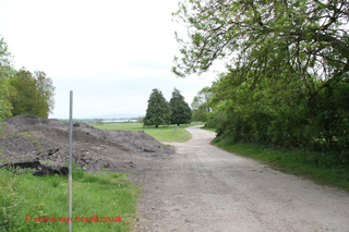
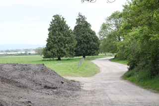
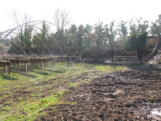
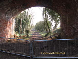
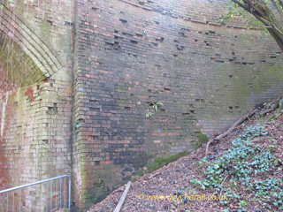
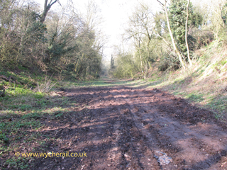
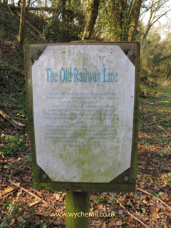
[280] | Overbridge No.115, Upper Hook Road. Still BRB(Residuary) responsibility. The bridge is a substantial brick structure, slightly skew of the railway line. Land towards Ashchurch now incorporated into Willingsworth Farm, better known today as Clive's Fruit Farm. Trackbed, on embankment, towards [275] is currently used as a free range piggery. Towards Malvern the track bed is walkable as far as [285] but access is not recommended or really practicable at this end. The notice at track level is positioned to be read by people approaching from under the bridge .. it reads
The Old Railway LineThe owner of Pigeonhouse Farm tells me the track wasn't lifted until 1961 - and he bought that part which had previously been part of his farm. Location MR275 [280] Pictures ... |
8 March 2011
Soft fruits to the left in season,
pigs through the gates
8 March 2011
part of Willingsworth farm house visible
8 March 2011
8 March 2011
8 March 2011
8 March 2011
8 March 2011
8 March 2011
8 March 2011
8 March 2011
walkable to [285]
8 March 2011
![]()
| Distance | Lat/Long | Pin | Location & Comments |
|---|---|---|---|
| N52.062874 W2.229078 |
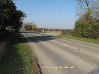
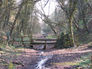
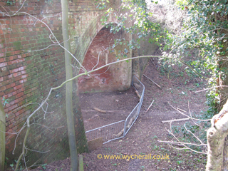
[275] | Underbridge, Cut Throat Lane. The bridge has gone and the footpath drops down the side of the embankment to road level. The northern end of Cut Throat Lane is now used as an access to the sewage disposal works which is located on the south side of the line. It is gated to deter four-by-four hooligans using the lane as an 'off road' route, only authorised vehicles to the sewage works are allowed. The whole length of it is bridleway 37 from Pool Brook to Tunnel Hill and can be used by horses and cycles (and people). An extract from the Worcester News of 1st February 2010 reads "Apologies, therefore, if Upton has disappeared under water by the time you read this. On the day the walk was checked, in late January, many fields were flooded and the intended route had to be altered. But flooding is nothing new in Upton and the very first footpath of the walk runs along the top of a causeway built centuries ago to provide a way into town during times of flood. It links Upton with a bridleway leading to slightly higher ground at Tunnel Hill. The bridleway goes by the rather grisly name of Cut Throat Lane and beside it is an equally grisly reminder of past hardship – the site of a burial ground from 1832 when so many Upton people died from waterborne cholera that there was no room for them in the churchyard." Location MR275 [275] Pictures ... |

8 January 2012
looking towards Upton in customary
wet mode, this is the road from Upton
to Brotheridge Green and Welland

8 January 2012
.. court is in session

8 January 2012
northern end viewed from the causeway

8 January 2012
looking towards the causeway

8 January 2012
looking towards Tunnel Hill, sewage
works entrance to left, bridleway to right

8 January 2012
the slope down from the embankment
the bridge was on the right hand
edge of the picture

8 January 2012
south side of line,
railway embankment behind
N52.06290 W2.22958

8 January 2012
immediately Malvern side of
Cut Thoat Lane bridge

8 January 2012
The section from 275 towards 280 is,
presumably, private but a reasonably well
defined path can be followed ..

8 January 2012
.. until we reach the piggery

8 January 2012
aka Clive's Fruit Farm

8 January 2012
south side of embankment by
Cut Throat Lane bridge at
N52.06317 W2.22962

8 January 2012
viewed looking towards Ashchurch
from the embankment
![]()
| Distance | Lat/Long | Pin | Location & Comments |
|---|---|---|---|
| N52.06111 W2.22343 |
[272] | Accomodation Underbridge. Location MR275 [272] Pictures ... |

8 January 2012
trackbed looking towards Ashchurch

8 January 2012
trackbed looking towards Malvern

8 January 2012
viewed from north side of line

8 January 2012
viewed from south side of line

8 January 2012
brickwork under the line
![]()
| Distance | Lat/Long | Pin | Location & Comments |
|---|---|---|---|
| N52.060572 W2.222075 |
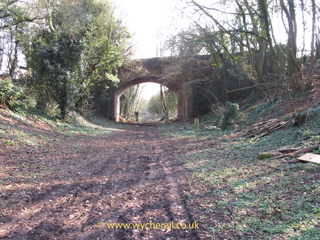
[270] | Footpath Underbridge. Location MR275 [270] Pictures ... |

8 January 2012
It must have been quite substantial if the
visible wall is the lower part of the original,
and it does look as though it is

8 January 2012
It must have been quite substantial if the
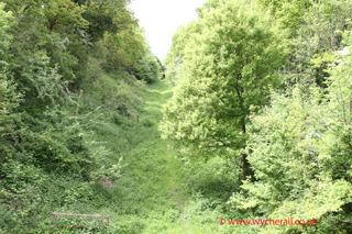
visible wall is the lower part of the original,
and it does look as though it is

8 January 2012
looking towards Ashchurch, embankment
removed to enlarge the sports grounds

8 January 2012
looking towards Malvern
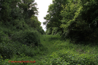
now an official footpath

8 January 2012
just a few feet from the start
of the surviving embankment at
N52.06065 W2.22205
![]()
| Distance | Lat/Long | Pin | Location & Comments |
|---|---|---|---|
| N52.059947 W2.220378 |
[265] | Underbridge. All trace of this went when the embankment was removed to allow extension of the playing fields. | |
| N52.059739 W2.219742 |
[260] | Mile post. Estimated position from 1886 OS map. Removed by MR Engineer c1907. | |
| N52.059495 W2.219052 |
[255] | Underbridge, Old Street (A4104), Upton-on-Severn. Location MR275 [255] Pictures ... |

8 January 2012
Gone, without a trace.
The car on the left marks the bridge position and the road turned sharp right in front of the yellow car.
Nowadays the road is re-aligned and the old section of road is just an access track and lay-bye

8 January 2012
'under the bridge'
looking towards Malvern, embankment
removed to enlarge the sports grounds

8 January 2012
'under the bridge'
looking towards Malvern, embankment
removed to enlarge the sports grounds

8 January 2012
'under the bridge'
looking towards Ashchurch
at Upton's Fire Station

8 January 2012
Behind the fire station the ground still
rises to the station and goods yard site
![]()
| Distance | Lat/Long | Pin | Location & Comments |
|---|---|---|---|
| 7m 17c | N52.058323 W2.216662 |
[245] | Upton-on-Severn Station. Originally Upton. Location MR275 [245] Pictures ... |

8 January 2012
looking towards Ashchurch

8 January 2012
looking towards Malvern

8 January 2012
an abandoned air about it

8 January 2012
an abandoned air about it

8 January 2012
an abandoned air about it

8 January 2012
looking towards Malvern
![]()
| Distance | Lat/Long | Pin | Location & Comments |
|---|---|---|---|
| 7m 14c | N52.057770 W2.216100 |
[240] | Upton-on-Severn Signal Box. Located on the down side. |
| N52.057298 W2.215648 |
[235] | Mile post. Estimated position from 1886 OS map. Removed by MR Engineer c1907. | |
| N52.056928 W2.215291 |
[230] | Footpath. The footpath is still here, but there is nothing to suggest the railway ever existed. Location MR275 [230] Pictures ... |

8 January 2012
looking towards Upton and Malvern

8 January 2012
looking towards Ashchurch
![]()
| Distance | Lat/Long | Pin | Location & Comments |
|---|---|---|---|
| N52.053910 W2.212331 |
[225] | Crossing, Rectory Road, Upton-on-Severn. Probably an occuptation (or user worked) crossing as it led to flood meadows and Buryend Farm. Location MR275 [225] Pictures ... |

8 January 2012
looking towards Upton and Malvern
nothing here to suggest a railway either
![]()
| Distance | Lat/Long | Pin | Location & Comments |
|---|---|---|---|
| N52.051253 W2.208630 |
[220] | Underbridge (stream). | |
| N52.049806 W2.203159 |
[215] | Mile post. Estimated position from 1886 OS map. Removed by MR Engineer c1907. | |
| 6m 21c | N52.049497 W2.201143 |
[210] | River Severn Bridge No.108, Saxon's Lode. The bridge is long gone but part of the wall seems to survive on the east side of the river, probably because a River Flow Measurement Station now occupies the railway alignment. On the west bank the embankment is trimmed back from the river and the Severn Way long distance path hugs the river bank. Location MR275 [210] Pictures ... |

15 January 2012
looking westwards where bridge 108 once proudly stood

15 January 2012
looking west across the River Severn.

15 January 2012
looking south

15 January 2012
a pill box still guards the
eastern end of the bridge

15 January 2012
roughly where the black sack bales are now
![]()
| Distance | Lat/Long | Pin | Location & Comments |
|---|---|---|---|
| 6m 16c | North Ground Frame, north end of Air Ministry Sidings on down side. | ||
| N52.048551 W2.197012 |
[205] | Mile post. Estimated position from 1886 OS map. Removed by MR Engineer c1907. Location MR275 [225] Pictures ... |

15 January 2012
looking towards Upton and Malvern the railway ran to the left of the green fence line
and the sidings were to the right, inside the compound, as viewed here from [200]
![]()
| Distance | Lat/Long | Pin | Location & Comments |
|---|---|---|---|
| 5m 77c | South Ground Frame, south end of Air Ministry Sidings on down side. | ||
| N52.047129 W2.195291 |
[200] | Overbridge No.107, Saxon's Lode, Uckinghall. Still BRB(Residuary) responsibility. Location MR275 [200] Pictures ... |

15 January 2012
the down line ran along the green strip in the middle and,
yes, that black blob is a surviving Permanent Way hut in the middle distance.

15 January 2012
looking towards Ashchurch
![]()
| Distance | Lat/Long | Pin | Location & Comments |
|---|---|---|---|
| N52.046058 W2.194518 |
[195] | Mile post. Estimated position from 1886 OS map. Removed by MR Engineer c1907. | |
| N52.044586 W2.193556 |
[190] | Footpath. Although shown on old maps this right of way has dissapeared over the years. Location MR275 [190] Pictures ... |

15 January 2012
made of old sleepers stood on end and a sleeper roof now covered in foliage. The 'cracks' in the wall were filled with cardboard and paper to keep out drafts. The farmer tells me the timber is now well rotted and it will soon be removed. Just Malvern side of [190] at N52.045017 W2.193728
![]()
| Distance | Lat/Long | Pin | Location & Comments |
|---|---|---|---|
| N52.042955 W2.192386 |
[185] | Underbridge ? | |
| N52.041745 W2.191462 |
[180] | Underbridge (footpath). | |
| N52.038345 W2.188822 |
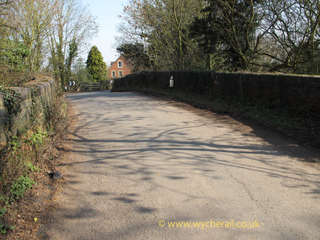
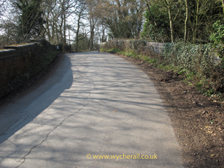
[175] | Overbridge No.106, Station Road, Ripple. Still BRB(Residuary) responsibility. Access under the bridge is via a narrow gate which is kept padlocked. Location MR275 [175] Pictures ... |

15 January 2012
north of the bridge has become a jungle

15 January 2012
south of the bridge lies the station

15 January 2012
the station buildings and platform are visible, modern buildings have been built on the forecourt

15 January 2012
north side

15 January 2012
south (station) side
![]()
| Distance | Lat/Long | Pin | Location & Comments |
|---|---|---|---|
| Ripple Signal Box (up side). | |||
| 5m 15c | N52.037247 W2.188011 |
[170] | Ripple Station. Remains as "Station House" with the main building and platform intact. New buildings have been erected in the forecourt. Although close to the road it is largely screened from view by hedges and trees. The nearby hostelry, opposite the station approach road, still retains the name "The Railway Inn" and widely advertises itself as a free house and restaurant. Location MR275 [170] Pictures ... |

15 January 2012
the brickwork is quite distinctive
![]()
| Distance | Lat/Long | Pin | Location & Comments |
|---|---|---|---|
| N52.035753 W2.187058 |
[165] | Footbridge (public footpath). The footpath is still here but of the footbridge, shown on 19th century maps, there is no trace. On Bow Lane, by the path entrance, there are eight bull head rails forming part of the fence. Each one still has a fish plate bolt in it. Location MR275 [165] Pictures ... |

15 January 2012
an inpenetrable jungle


15 January 2012
with fishplate bolt
![]()
| Distance | Lat/Long | Pin | Location & Comments |
|---|---|---|---|
| [162] | There were once gravel pits and a tramway between the footpath and the later route of the M50. No trace now, probably filled in. Location MR275 [162] Pictures ... |

15 January 2012
![]()
| Distance | Lat/Long | Pin | Location & Comments |
|---|---|---|---|
| N52.032438 W2.184024 |
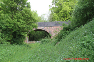
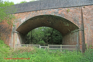
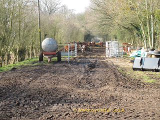
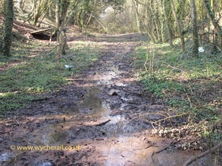
[160] | Underbridge, M50. Built much to the annoyance of the Ministry Against Rail Transport because BR would not close the railway just to suit the road builders. Either when built, or soon after, a water main was carried over the bridge which ensured its survival long after the railway did close. A notice in October 2011 allowed an 18 month period for temporary closures of Bow Lane to allow diversion of the water pipe, lifting out the railway bridge and strengthening the road bridge. Location MR275 [160] Pictures ... |

15 January 2012
water main in pipe on up side

15 January 2012
water main diversion under way

15 January 2012
water main diversion under way

15 January 2012
south end, all four corners had steps

15 January 2012

15 January 2012
.. make fine plant pots

15 January 2012

15 January 2012

15 January 2012
looking towards The Twittocks

15 January 2012
looking towards the west
![]()
| Distance | Lat/Long | Pin | Location & Comments |
|---|---|---|---|
| N52.030499 W2.181819 |
[155] | Accommodation Crossing (?). May have been created since railway closed. | |
| 4m 26c | N52.026296 W2.177750 |
[150] | Worcestershire - Gloucestershire County Boundary. The railway was on an embankment here. The bridge is over Mythe Brook which is the county boundary at this point, thus the bridge straddles the county boundary as well as the water. Location MR275 [150] Pictures ... |

15 January 2012
![]()
| Distance | Lat/Long | Pin | Location & Comments |
|---|---|---|---|
| 4m 22c | N52.025754 W2.177143 |
[145] | Underbridge, Bow Lane. Abutments still BRB(Residuary) responsibility. Location MR275 [145] Pictures ... |

15 January 2012

15 January 2012

15 January 2012
brickwork detail,
clearly built for a double line railway
![]()
| Distance | Lat/Long | Pin | Location & Comments |
|---|---|---|---|
| N52.016250 W2.171991 |
[130] | Overbridge. | |
| N52.012859 W2.170953 |
[125] | Underbridge, footpath | |
| N52.010395 W2.168590 |
[120] | Underbridge, The Stalls | |
| 3m 41c | N W |
North No.1 Ground Frame | |
| 3m 16c | N W |
North No.2 Ground Frame | |
| 2m 59c | N W |
[115] | Tewksbury Tunnel No.99, north portal. |
| 2m 40c | N52.002636 W2.161277 |
[110] | Tewksbury Tunnel No.99, south portal. 418 yards in length. Sometimes called Mythe Tunnel. |
| N52.002219 W2.160876 |
[105] | Underbridge, accomodation; or accomodation crossing. | |
| N52.001792 W2.160349 |
[100] | Underbridge, accomodation; or accomodation crossing. | |
| N52.000069 W2.157468 |
[95] | Underbridge, accomodation. | |
| 2m 15c | N51.999462 W2.156059 |
[90] | Three Arches Viaduct, Old River Avon. |
| 2m 09c | N51.998846 W2.154748 |
[85] | Avon Bridge No.94. |
| N51.998141 W2.153113 |
[80] | Underbridge, Bredon Road, Tewksbury. | |
| N51.997062 W2.151004 |
[75] | Underbridge, Cotteswold Road, Tewksbury. | |
| N51.996483 W2.149196 |
[70] | Underbridge, Station Lane, Tewksbury. | |
| 1m 61c | N51.996293 W2.148130 |
[65] | Tewksbury Station. Also single road loco shed latterly sub-shed to Gloucester 22B. |
| 1m 52c | N W |
[60] | Tewksbury Station Signal Box. Located in the vee of the junction. |
| 1m 47c | N51.996321 W2.144042 |
[55] | Quay Branch Junction. Original route into Tewksbury joins on up. |
| N51.996760 W2.142195 |
[50] | Underbridge, Northway Lane, Tewksbury. | |
| N51.997739 W2.133459 |
[45] | Underbridge, Gannaway Lane, Tewksbury. | |
| 1m 00c | N51.998004 W2.129399 |
[40] | Milepost. Estimated position from 1886 OS map. |
| N51.998650 W2.123267 |
[35] | Intersection with M5 Motorway, built since closure of railway. | |
| N51.998861 W2.120848 |
[30] | Intersection with Alexandra Way, built since closure of railway. | |
| N51.999387 W2.112231 |
[25] | Tewksbury Junction. Connection to Provender Store sidings that ran north east through what is now Northway Trading Estate and joined up with the Birmingham & Gloucester main line. | |
| N51.999344 W2.112040 |
[20] | Overbridge No.89, Northway Lane. Still BRB(Residuary) responsibility. | |
| 0m 17c | N51.999339 W2.111891 |
[15] | Tewksbury Junction. Ashchurch & Evesham line joins on down. |
| 0m 13c | N W |
Tewksbury Junction Signal Box. Located in vee of the junction on Midland Railway Distance Diagrams. OS map of 1886 seems to show it immediately west of Northway Lane bridge. | |
| 0m 07c | N51.998483 W2.109065 |
[5] | Ashchurch Station. Sometimes referred to in Bradshaw as Ashchurch for Tewksbury (1861), and again in 1961. |
| 0m 00c | N51.997908 W2.108758 |
[0] | Tewksbury Line Junction, line diverges from Birmingham & Gloucester Railway, junction facing for trains from Gloucester. |
| *** MR277 *** | |||
|---|---|---|---|
| Distance | Lat/Long | Pin | Location & Comments |
| 2m26c | N51.995705 W2.160805 |
[60] | Tewksbury Quay and end of branch. |
| 2m 17c | N51.995224 W2.158695 |
[55] | Healing's Siding |
| N51.995199 W2.158015 |
[50] | Underbridge, River Avon | |
| 2m 12c | N51.995006 W2.156555 |
[45] | High Street Level Crossing |
| 2m 09c | N51.994930 W2.155705 |
[40] | Tewksbury Old Station |
| 2m 07c | N51.994959 W2.155215 |
[35] | Oldbury Road Level Crossing |
| 2m 06c | N W |
[30] | Engine Shed Siding |
| 1m 77c | N51.994883 W2.152328 |
[25] | Chance Street Level Crossing. |
| 1m 75c | N W |
[20] | Downing's Siding. |
| 1m 69c | N51.995279 W2.149544 |
[15] | Tewksbury Goods. |
| N51.995235 W2.147934 |
[10] | Goods Yard entrance points | |
| 1m 52c | [5] | Tewksbury Station Signal Box. See MR275 for details. | |
| 1m 47c | [0] | Quay Branch Junction. See MR275 for details. | |
| *** MR274 *** | |||
|---|---|---|---|
| Distance | Lat/Long | Pin | Location & Comments |
| 84m 42c | N52.000476 W2.107014 |
[0] | Evesham Junction, datum point Derby London Road Junction via Whiteacre Junction, Camp Hill and Evesham. |
| N52.000126 W2.107738 |
[5] | Footpath or occupation crossing. | |
| 84m 50c | N51.999785 W2.108765 |
[10] | Flat crossing of Birmingham to Gloucester Line. |
| 84m 58c | Tewksbury Junction Signal Box. See MR275 for details. | ||
| 84m 62c | Tewksbury Junction. See MR275 for details. | ||